Amresh Parab
Panaji
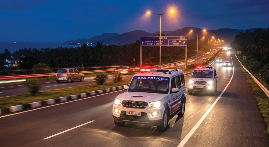
Goa Police is set to strengthen highway patrolling by deploying additional vehicles and implementing a detailed operational plan to enhance police visibility and ensure quick response to distress calls.
A senior police officer told ‘The Navhind Times’ that seven more four-wheelers will be added to the current fleet of three highway patrol vehicles.
Under the newly prepared operational plan, 10 different locations have been identified at equal intervals along the state’s national highways. The 10 vehicles will be stationed at these spots, with each vehicle patrolling a 22-kilometre stretch to ensure forward and return distances remain similar. The major national highways in the state include NH-66 from Pernem to Canacona, NH-748 from Panaji to Mollem and NH-566 linking Vasco and Ponda.
In addition to strengthening highway patrols, the police are introducing two-wheelers to the Police Control Room (PCR) fleet, which currently relies on over 55 four-wheelers. According to an officer, the two-wheelers will help police navigate traffic hurdles easily and reach incident spots within minutes, further improving response time.
The Goa Police has already succeeded in considerably cutting down PCR vehicle response times from over 18 minutes in December 2023 to 8.27 minutes in June 2026.
Director General of Police (DGP) Alok Kumar previously stated that the target is to bring this response time down to around six minutes as more vehicles join the fleet. Currently, the active fleet consists of 48 PCR vehicles – including the three highway patrol vehicles – along with 10 Pink Force vehicles.
The technological foundation for these improvements dates back to October 2019, when Chief Minister Pramod Sawant inaugurated the Emergency Response Support System (ERSS) control room and flagged off PCR vans fitted with mobile data terminals (MDT). The project was executed by the Centre for Development of Advanced Computing (C-DAC), a premier institution under the Union Ministry of Electronics and Information Technology.
The system allows call receivers to instantly view a caller’s details and locate them precisely on a Geographical Information System (GIS) map, immediately routing the call to the nearest emergency vehicle’s MDT without delay.